Apple Maps Gains Detailed Terrain Features for Arizona, New Mexico, and Nevada US States - MacRumorsOpen MenuShow RoundupsShow Forums menuVisit ForumsOpen Sidebar
Skip to Content

Apple Maps Gains Detailed Terrain Features for Arizona, New Mexico, and Nevada US States

by

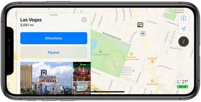
As part of its ongoing effort to rebuild Apple Maps, Apple has added detailed terrain features to the U.S. states of Arizona and New Mexico as well as the southern portion of Nevada, including the city of Las Vegas.

apple maps las vegas terrain
The enhancements are the result of Apple's street-level data collection using LiDAR-equipped vehicles, which has been going on for over three years. Related improvements first rolled out in Northern California in iOS 12 and have extended to Hawaii and Southern California over the past few months.

The overall look and feel of ‌Apple Maps‌ is mostly the same, but zooming and panning reveals more details like grass, trees, sports fields, and parking lots. Apple says search results also become more relevant.

‌Apple Maps‌ vehicles have been collecting mapping data in the United States since 2015, with over 45 states at least partially surveyed to date. Apple will begin surveying Alaska, South Carolina, and Tennessee between March and July, according to an update to its recently revamped Apple Maps image collection website.

Back in June 2018, Apple said the revamped mapping data would roll out section by section across the rest of the United States over the following year. Since then, a pattern has emerged that appears to show Apple prefers rolling out the updated maps in adjacent continental U.S. states, rather than prioritizing more population-rich regions of the nation like the Northeast.

Our source notes that Apple is also working on an updated appearance for northeastern cities like New York, given that special detailed terrain features can be seen – perhaps unintentionally – when entering turn-by-turn navigation.

(Thanks, Dante!)

Top Rated Comments

94 months ago
Can I still drive on to the runway at the airport. Or is that not actually a feature?
I much more preferred google maps, especially enjoyed the container lorries ending up on cycling paths and cars driving off the cliff. Fun fun, if you are a numb-nuts and don’t look where you are driving to.
[doublepost=1556193003][/doublepost]
Right, because you can't start on other regions of the world when you're doing the current one.

Google street view took two years to release just a few cities at first and then added more places faster and faster. Apple has covered all of California and Hawaii in the past year, which is pretty good progress for a pilot release. Expect releases to ramp up in a similar way for Apple as they work out the kinks in their new data.
Sorry, but you are too rational for this blog. I would recommend the “Google maps are the best” approach, followed by “Apple Maps suck”, or you are going to be called a fanboy and will be disliked in here.
Score: 11 Votes (Like | Disagree)
Aluminum213 Avatar
94 months ago
So only another 50 years left before it matches Google maps
Score: 9 Votes (Like | Disagree)
94 months ago
So nearly one country in four years.
Score: 8 Votes (Like | Disagree)
mcrawley Avatar
94 months ago
Can someone at Apple please add a scale to their maps?


I get an air quality index and temp but no indicator of distance, a fundamental thing maps measure.
Score: 6 Votes (Like | Disagree)
szw-mapple fan Avatar
94 months ago
So nearly one country in four years.
Right, because you can't start on other regions of the world when you're doing the current one.

Google street view took two years to release just a few cities at first and then added more places faster and faster. Apple has covered all of California and Hawaii in the past year, which is pretty good progress for a pilot release. Expect releases to ramp up in a similar way for Apple as they work out the kinks in their new data.
Score: 6 Votes (Like | Disagree)
gwhizkids Avatar
94 months ago
It is there, appearing in the upper left corner when you start zooming in/out of it.
You learn something new every day! Had never noticed that before. One reason why is that it disappears a little too quickly. But it is there!
Score: 5 Votes (Like | Disagree)

Popular Stories

Apple Maps General

Apple Maps Flyover Gets a Visual Upgrade in iOS 27

Monday June 8, 2026 4:29 pm PDT by
Apple Maps is getting a visual update in iOS 27, with Apple planning to introduce new aerial imagery that's combined with Visual Intelligence models. Apple said everything will have sharper detail, from the "shapes of individual trees to the way light reflects off the glass of skyscrapers." Flyover is an Apple Maps view that lets users see more than 350 cities in 3D with detailed...
Apple Says iOS 27 Adds These 12 New Features to Your iPhone Feature

Apple Says iOS 27 Adds These 12 New Features to Your iPhone

Tuesday June 9, 2026 9:47 am PDT by
iOS 27's key new feature is a more intelligent and personal version of Siri, but the changes go well beyond that. In a press release, Apple outlined additional enhancements coming across Apple Maps, Find My, Apple Wallet, Apple Music, and more. Apple Maps has gained an enhanced Flyover experience powered by AI, enabling you to view aerial imagery in "stunning detail" for select cities. In ...
liquid glass app icon

Apple Maps to Get These 10 New Features in iOS 27

Thursday June 11, 2026 5:45 am PDT by
Apple Maps is getting a range of new features in iOS 27, headlined by an upgraded Flyover experience that uses AI to improve the realism and detail of its aerial imagery. Flyover is a longstanding feature of Apple Maps and lets users explore more than 350 cities in 3D with detailed landmarks, roads, parks, and buildings. Apple described the enhanced Flyover in iOS 27 as combining aerial...