Apple Maps Begins Surveying Poland for 'Look Around' - MacRumorsOpen MenuShow RoundupsShow Forums menuVisit ForumsOpen Sidebar
Skip to Content

Apple Maps Begins Surveying Poland for 'Look Around'

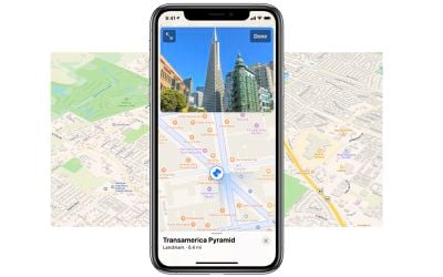
Apple Maps has begun surveying Poland for its "Look Around" feature, which offers users a 360-degree immersive panoramic look of a city or location.

apple maps and look around
Apple maintains an updated list of countries, cities, and territories of where it is conducting ground surveys for Look Around. That list was recently updated with the addition of Poland. Additionally, a photo shared on Facebook shows an ‌Apple Maps‌ image collection vehicle in Poland. Apple says that the "vehicle ground-based research" of Poland will continue until August of this year.

Last month Apple began surveying Hong Kong for Apple Maps as it contuines its ambition to widen the availability of ‌Apple Maps‌ features to more locations. A full list of where ‌Apple Maps‌ is currently surveying can be found on Apple's website.

(Thanks, Piotr)

Popular Stories

Apple Maps General

Apple Maps Flyover Gets a Visual Upgrade in iOS 27

Monday June 8, 2026 4:29 pm PDT by
Apple Maps is getting a visual update in iOS 27, with Apple planning to introduce new aerial imagery that's combined with Visual Intelligence models. Apple said everything will have sharper detail, from the "shapes of individual trees to the way light reflects off the glass of skyscrapers." Flyover is an Apple Maps view that lets users see more than 350 cities in 3D with detailed...
Apple Says iOS 27 Adds These 12 New Features to Your iPhone Feature

Apple Says iOS 27 Adds These 12 New Features to Your iPhone

Tuesday June 9, 2026 9:47 am PDT by
iOS 27's key new feature is a more intelligent and personal version of Siri, but the changes go well beyond that. In a press release, Apple outlined additional enhancements coming across Apple Maps, Find My, Apple Wallet, Apple Music, and more. Apple Maps has gained an enhanced Flyover experience powered by AI, enabling you to view aerial imagery in "stunning detail" for select cities. In ...
liquid glass app icon

Apple Maps to Get These 10 New Features in iOS 27

Thursday June 11, 2026 5:45 am PDT by
Apple Maps is getting a range of new features in iOS 27, headlined by an upgraded Flyover experience that uses AI to improve the realism and detail of its aerial imagery. Flyover is a longstanding feature of Apple Maps and lets users explore more than 350 cities in 3D with detailed landmarks, roads, parks, and buildings. Apple described the enhanced Flyover in iOS 27 as combining aerial...

Top Rated Comments

67 months ago
I did not know that the pictured Transamerica Pyramid was in Poland 😀
Score: 9 Votes (Like | Disagree)
67 months ago

What about Siri in Polish?
According to Google Translate, it is just "Siri". :D
Score: 7 Votes (Like | Disagree)
sunapple Avatar
67 months ago

Anyone got experience of how long it has taken from survey to actually being available?
Could be years. My parents saw an Apple Maps vehicle by their house last summer even though they live in a smaller village. The feature is still not available here in The Netherlands, yet Apple seems to be covering the whole country already. Meaning they could very well be waiting until they get every part of the country mapped before release.
Score: 7 Votes (Like | Disagree)
nvmls Avatar
67 months ago
*Coming soon™

*2050 with luck
Score: 4 Votes (Like | Disagree)
67 months ago

So much duplication of effort going on. Hopefully one day, all the major map providers will have a data sharing agreement.
An awful lot of me agrees. But multi-sourcing of data has huge advantages when it comes to verification.

In the past, the specific highly detailed street map which included my house had the house numbers wrong. These maps were surveyed by the Ordnance Survey who served as the source for the majority of UK maps. Thus, pretty much every map which was sufficiently detailed would carry the same mistake.

I'd like to think that a combination of data sources - OpenStreetMap being one example for today - would far more likely raise a clash warning and see someone check. (Were I in the same position today, I'd flag the issue, but in those days, writing a physical letter seemed over the top for a small error.)

So, yes to data sharing but not if it results single sourcing.
Score: 3 Votes (Like | Disagree)
CarlJ Avatar
67 months ago

So much duplication of effort going on. Hopefully one day, all the major map providers will have a data sharing agreement.
It’s early enough that it’s probably a good thing that we have multiple sources for this imagery, so if one of them gets a particular location wrong, you can check the other.
Score: 3 Votes (Like | Disagree)